Perusahaan ini terdaftar sebagai Free Member. Hindari melakukan pembayaran sebelum bertemu penjual atau melihat barang secara langsung. COD (Cash On Delivery) atau bertemu langsung dengan penjual merupakan metode transaksi aman yang kami sarankan.
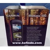
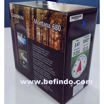
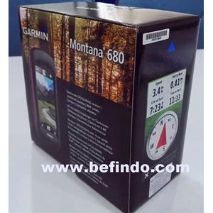
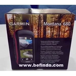
GPS Map GARMIN MONTANA 680 adalah Gps keluaran terbaru dari Garmin untuk menggantikan MONTANA 650 yang sudah habis masa produksinya,
GARMIN MONTANA 680 memiliki fitur fitur dan keunggulan di bandingkan MONTANA 650. Keunggulan dari MONTANA 680 adalah :
Layar sebesar 4 inch dan kamera autofocus 8 megapixel dan internal memory sebesar 4 gigabyte, bisa diperbesar dengan memory tambahan,
High-sensitivity, WAAS-enabled GPS Receiver dengan HotFix® dan GLONASS support. untuk penerimaan sinyal satelit yang sangat cepat.
GARMIN MONTANA 680 memiliki spesifikasi :
# Physical & Performance :
- Physical dimensions : 2.9" x 5.7" x 1.4" (7.48 x 14.42 x 3.64 cm)
- Display size, WxH : 2"W x 3.5"H (5.06 x 8.93 cm); 4" diag (10.2 cm)
- Display resolution, WxH : 272 x 480 pixels
- Display type : bright, transflective 65k color TFT, dual-orientation touchscreen; sunlight readable
- Touchscreen capability
- Weight : 10.2 oz (289 g) with included lithium-ion battery pack; 11.7 oz (333 g) with 3 AA batteries (not included)
- Battery : rechargeable lithium-ion (included) or 3 AA batteries (not included); NiMH or Lithium recommended
- Battery life : up to 16 hours (lithium-ion); up to 22 hours (AA batteries)
- Water rating IPX7
- High-sensitivity receiver
- Interface high-speed USB and NMEA 0183 compatible
# Camera
- yes (8 megapixel with autofocus; automatic geo-tagging)
- Barometric altimeter
- Electronic compass Yes (tilt-compensated 3-axis)
- Unit-to-unit transfer (shares data wirelessly with similar units)
# Maps & Memory :
- Basemap
- Ability to add maps
- Built-in memory 4 GB
- Accepts data cards microSD™ card (not included)
- Custom POIs (ability to add additional points of interest)
- Waypoints/favorites/locations 4000
- Routes 200
- Track log 10,000 points, 200 saved tracks
# Outdoor Features :
- Automatic routing (turn by turn routing on roads) Yes (with optional mapping for detailed roads)
- Geocaching-friendly Yes (Paperless)
- Custom maps compatible
- Hunt/fish calendar
- Sun and moon information